SOLVIOR SUNSYSTEMS – Aerial
3D Digitization
learn more
Future Trends in Engineering Design
Discover the advantages of drone-based aerial 3D scanning.
Sustainable Designs
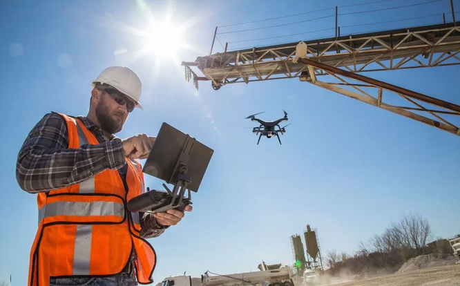
Drone-based aerial 3D scanning offers an innovative solution for fast and precise digitalization, opening new
dimensions in engineering and architectural design. The resulting highly
detailed 3D point
cloud enables the creation of files that can be further processed in AutoCAD in DWG
format, simplifying and accelerating design workflows.
Precision Engineering
Perfect accuracy, unmatched detail
Drone scanning enables
the production of high-resolution orthophotos that provide a precise
foundation for site plans and 2D drawings. Data captured in the EOV coordinate system ensures
that designs always align accurately with the real environment.
Innovate & Create
BIM modeling and AR applications The generated 3D point cloud can be directly integrated into BIM (Building Information Modeling) systems, elevating building
information modeling to a new level. The data can also be utilized in AR (augmented reality)
applications, enabling virtual
design and visualization in real-world environments.
Faster surveying, more efficient design
Drone scanning can map vast areas within hours, significantly reducing the time required by traditional surveying
methods. The data can be easily exported
into DWG format,
enabling further editing and design in AutoCAD.
learn more
Future-Ready Project Intelligence
Choose the technology of the future and increase your project efficiency with drone-based 3D scanning!
read more
Engineering Excellence
A revolutionary aerial data acquisition system built on Archicad and Revit foundations that iteratively generates a global point cloud of complex surfaces using
contour-following motion planning software. It reduces the need for manual
pilot planning and photogrammetric image capture through simple automation.
The drone
autonomously navigates within
the user-defined scanning
space, ensuring comprehensive imaging of all surfaces with predefined resolution and overlap.
It enables complex scans even in GPS-denied environments, such as indoors or
under overhangs, without requiring prior knowledge of the structure.
Operators can define operational boundaries by restricting the drone to a user-specified scanning volume. This approach provides greater accuracy
than GPS-based methods, as the boundaries adapt to the scanning volume, and it
reduces ground risks in environments such as crowded areas, bridges, highways,
or tactical BVLOS-permitted zones.
Revolutionary Designs
Our Drone Engineers create everything from bridges and buildings to PV and BESS power plant layouts. They play a crucial role in developing sustainable technologies, enhancing civil works environment and continuous constrtuction projects.
VISUALIZATION
An
edge computing solution that allows the pilot to view a simplified 3D model of
the scanned scene in a web application delivered directly by the drone to a
laptop or mobile device in the field.
more
DATA Export
Operators can seamlessly upload and export scan photos with full metadata from Skydio Cloud or from the drone’s SD card for use in third-party
photogrammetry software.
more
TRACEABILITY
Using
computer vision, the drone visually repositions itself so it can resume
scanning exactly where it left off, even without GPS.
more
Creative Solutions
Drone Engineering plays a crucial role in shaping the world we live in today and tomorrow.
more
Smart Engineering
Innovation and creativity are fundamental to the field of aerial engineering for continuous advancements.
more
Future Designs
Our Engineers work collaboratively to create solutions that enhance efficiency, sustainability, and quality of life.
more
The Role of Drone Surves in Engineering
Operators can view scanned
surfaces in real time through
an augmented reality
(AR) interface. This allows the user
to identify potential gaps and track
scanning progress. Completeness verification reduces the need for re-flights
while ensuring full coverage.
learn more
Inventive Engineering
 Efficient Systems
Engineering drives technological innovation.
 Cutting-Edge Tech
Engineers design solutions creatively.
 Ingenious Solutions
Engineering shapes our future.